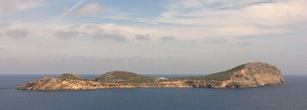
Hotels at Tagomago Hotels at Tagomago booking.com

previous island Vedrà island Tagomago next island Espalmador

Booking.com

Youtube Tagomago Video - Movie


For a detailed description of this island, see our info-island-page:Tagomago

Physical characteristics - Location

Coordinates: long: 1.64372 lat : 39.03653
Coordinates (gr,min,sec): WGS84long: 1°38'37.4028 lat : 39°2'11.4936
Surface area: 0.6 km2 (0.002 x Isle of Wight)
Length coastline: 5.3 km
Average height: 39 metre
Length island: 1.5 km
Maximum width island (estimate): 0.11 km
Name : not known/no name (86.3 metre)
Orientation island: Northwest - Southeast

Demographic data island

Habited: No
Number of inhabitants: 0
Population density: 0.00 inh/km2

Naming - Location

Local native name: Isla Tagomago
Archipelago (island group): Balearic Islands
Neighboring islands
(Island hopping):
1) Ibiza 1.5 km WestSouthWest
2) Espardell 29 km SouthSouthWest
3) Espalmador 32.4 km SouthWest
4) Formentera 34.2 km SouthSouthWest
5) Conejera 36.8 km West
6) Vedrà 42.1 km WestSouthWest
7) Dragonera 81.9 km NorthEast
8) Mallorca 82.5 km NorthEast
9) Cabrera 110 km East
10) Conejera 114.1 km East
11) Islas Columbretes 125 km NorthWest
12) Benidorm Island 164.6 km WestSouthWest
13) Tabarca 207.2 km WestSouthWest
14) Menorca 211.3 km EastNorthEast
15) Illa d’en Colom 247.8 km EastNorthEast
16) Isla Mayor o del Baron 257.3 km SouthWest
17) Medes Islands 359.3 km NorthNorthEast
18) Isla de Alboran 537 km SouthWest
19) Pheasant Island 556.3 km NorthNorthWest
20) Isla del Rey 559.3 km SouthWest
21) Île Pomègues 559.4 km NorthNorthEast
22) Isla de Isabel II 559.6 km SouthWest
23) Isla del Congreso 560.4 km SouthWest
24) Île Ratonneau 561.3 km NorthNorthEast
25) Santa Clara eiland 564.6 km NorthNorthWest
Country: Spain
Location in Country: East-southeast
Name Comunidad autónoma: Autonomous Community Balearic Islands
Name Provincia: Province Balearic Islands
Places portal2europe
(sister website):
Can Domingo (Central)

Sea: Balearic Sea
Distance to main land: 126 km
Nearest Country: Spain
island-Type: island in sea
Remarks: Privately owned island at the eastern coast of Ibiza.


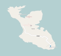
Topographic islandmap Tagomago

Tagomago map

© OpenStreetMap-auteurs, CC-BY-SA.
Map Tagomago

Tagomago views: 3164

5 starsaverage score: 5 from 1 votes.

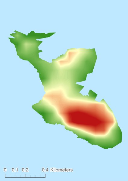
Height map of Tagomago

Tagomago Digital terrain model - DTM


Relief: Height Classes in percentages


Relief: Slope Classes in percentages


Weather at Tagomago

The weather type in Santa Eulària des Riubroken cloudsweericoon
Current temperature: 22 degrees Celcius
Precipitation last 3 hours: No precipitation
Wind: 2.71 meter per second (Wind force - bft 2)
Winddirection: West-northwest
Atmospheric pressure: 1014 mb
Humidity: 74 %
Daylength at 12 September 2024:12 hour and 35 minutes
Sunrise: 07:32 Europe/Amsterdam
Sunset: 20:07 Europe/Amsterdam
Weather-page: Tagomago

The weather for the next few hours

Santa Eulària des Riu - ES (longitude: 1.6437, latitude: 39.0365)
Distance weather station to the center island (direction N): not known
5:00
23 degrees Celcius
1014 mbar
light rainweericoon
8:00
24 degrees Celcius
1014 mbar
scattered cloudsweericoon
11:00
26 degrees Celcius
1013 mbar
light rainweericoon
14:00
27 degrees Celcius
1012 mbar
light rainweericoon
17:00
24 degrees Celcius
1013 mbar
light rainweericoon

Climate: Temperature and Precipitation


Transport on your island-holiday

Directly accessible from Western Europe (The Netherlands) by plane: No
International airport present : No
Accessible by car: No
Distance from Western Europe (The Netherlands) (rough estimate): 1914 km
Ferry connection - Car - Car - with mainland: No
Bicycle facilities: No

island-Sights, island-Tourism - island-attractions

Wikipedia Tagomago ?> Wikipedia: Wikipedia Tagomago
Tourist information: Info Tagomago
Youtube: Youtube Tagomago


island accommodation: Hotel ,Holiday Home, Camping

Hotel at Tagomago ?> Hotel Hotel at Tagomago booking.com
Campings at Tagomago ?> Camping Not known
Holiday Home
Bed & Breakfast
accommodation-page Tagomago


Social media - Multimedia

Youtube Video TagomagoVideos youtube Tagomago
flickr pictures and images of TagomagoPhotos (Flickr) of the place Tagomago


Bings maps Tagomago
Mapquest Tagomago
Loc.Alize.us Tagomago

Landuse Tagomago

 Forest   0 km2 
 0% 
 Nature   0.6 km2 
 97% 
 Agriculture   0 km2 
 0% 
 Wet nature   0 km2 
 0% 
 Water   0 km2 
 3% 
 Urban area   0 km2 
 0% 
 Infrastructure   0 km2 
 0% 
 Viticulture   0 km2 
 0% 
 Rock outcrop   0 km2 
 0%